Tanner's Brook, may, as the name suggests, relate to an historic tan-house along the brook, using its water supply. Reverand William Elliot in his Place names of Wyre Forest has commented on this, pointing out a house on the brook named Tanners Bow. He also suggested that the Lem Brook means the clear brook, having the same derivation as the Leam which flows through Leamington. Perhaps the water didn't run as clear further south where the stream becomes known as Tanner's Brook. Tanning was a notoriously smelly and messy business! Gybhouse Colliery was located just to the east of Tanners Brook (and east of Bayton Common). It is thought to have been in production from 1867 to 1893.
Our volunteer for this stretch, Tony Leach, has found no evidence of these two industries but has photographed earthworks south-east of Bayton Common which are thought to be 20th century in date as they are shown on the 2nd Edition Ordnance Survey map but not the 1st Edition. The suggestion is that this was a colliery or gravel pit site but Tony believes that they are old clay pits, and that the clay was used to construct an embankment on the stream at this point as the banks show evidence of white/grey clay deposits. Does anyone know more about these earthworks? Any comments would be welcome.
 |
| Earthworks south-east of Bayton Common |
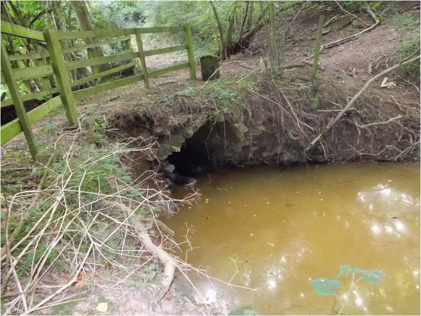
Also recorded and photographed on Tanners Brook were an undated stone culvert, which is showing signs of collapse, and a bridge north of Badgers Walk.
 |
| Undated stone culvert |
 |
| Bridge near Badgers Walk |
A boundary stone which is shown on some maps, was photographed on Tanners Brook on which you can see ?M, L on one side and R, L on the other.
 |
| Boundary marker stone inscribed 'M, L' |
 |
| Boundary stone inscribed 'R, L' |
It is most likely to be a property boundary marker - a private property marker or a dole stone, marking out land doled out to local residents. These were used to mark out parcels of land, and the initials represented those of the landowner or the registered land user. In this case it may mark the boundary of two plots of woodland coppice or pasture. A similar stone was found at Upton-on-Severn during flood alleviation works, which has also been interpreted as a dole stone, and also bears the letter M L.
The boundary stone is on the Shropshire side of the brook, so we just miss out on the opportunity to check the names of land owners and tenants through the Worcestershire Tithe and Inclosure maps online. Not that the stone necessarily dates from the same period.
Further downstream, on the Lem Brook, an old hydraulic ram pump was found. It bears the name Green and Carter Ltd, Vulcan Works.
 |
| Ram pump on the Lem Brook |
Green and Carter Ltd has been making and installing Vulcan and Vacher rams for over 100 years. These pumps are ideal for remote situations and are still an eco-friendly solution for pumping water. Even old pumps made before 1800 can be restored and brought back into use as the company still manufactures the parts. The company is also unusual in having all its records dating back to 1774, and from 1860 has every letter ever written or received by the company. This has helped with restoring old pumps (by identifying the model and the parts needed), an example being the restoration of ram pumps at the Lost gardens of Heligan in Cornwall.
Thanks are due to Tony Leach who surveyed this stretch of stream (all photographs are also courtesy of Tony Leach).
By Liz Pearson
lpearson@worcestershire.gov.uk, Google+
No comments:
Post a Comment